Does a postcode actually affect your safety?
A practical breakdown for students deciding where to live in London.
As a newcomer in London, the search for a home does not really start with the rent. It starts with a warning.
For example, a person might say that a specific postcode is sketchy. A parent might send you an article or a blog about something. A friend might tell you that you should not be living in a specific place. Even before you sign a tenancy agreement, a story has already been created, even if you do not know all the facts.
It is well known that the postcodes in London can either be good or bad, and this judgement may be said to be absolute. However, it is essential to understand that the difference between belief and reality is fundamental in deciding your place of living.
Globally, London is often portrayed as being on the brink of a crime crisis, and these anxieties are sometimes weaponised in political arguments about the city and its leadership. When new figures showed London’s homicide rate at its lowest level in decades in 2025, Mayor Sadiq Khan said the figures “disprove claims spread by U.S. President Donald Trump and others on the political right that crime is out of control in Britain’s capital,” and accused some politicians and commentators of “painting an image of a dystopian London.” This underlines how crime statistics can be pulled into wider culture‑war narratives.
Recent London Government figures complicate that story: in the twelve months to March 2025, “there were 26.40 recorded violence against the person offences per 1,000 population in the Met area, which is below the national average of 31.88 per 1,000 population,” and Londoners are “less likely (7.3 offences per 1,000 population) to be a victim of violence with injury than across the rest of England and Wales (8.5 offences per 1000 population).”
In other words, whereas some commentators, such as international politicians, portray London as a city that is violently dangerous, the evidence from the past couple of years indicates that it is actually a safer city than many people think.
What crime statistics really mean, and what they really don’t mean
The Metropolitan Police Service (MPS) publishes crime statistics for London neighbourhoods on its crime map. This map lets users enter a postcode and examine crime occurrences by category. Thefts, burglaries, robberies and antisocial behaviour can all be viewed by the numbers.
Of course, the figures for crimes committed in a city may appear quite straightforward: the higher the figures, the higher the level of danger; the lower the figures, the safer you are.
Even for violent offences, recent Met and City Hall data shows there has been an 18 per cent reduction in Violence with Injury offences recorded by the Metropolitan Police, and that violent crime with injury in London is now lower than in the rest of England and Wales.
Crime statistics, however, do not exist in a vacuum.
The weight of reputation
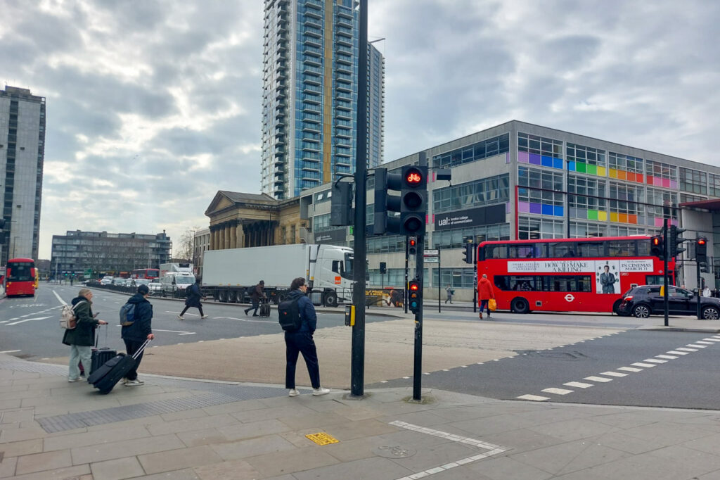
Postcodes tend to have a narrative that lasts for a great length of time beyond the actual circumstances that originally gave rise to that narrative.
One of the best examples of this is the area known as Elephant and Castle.
“People warned me that Elephant and Castle could be scary and told me not to take my camera out,” says Manas Godara, 27, a first‑year MA Commercial Photography student at the University of the Arts London (UAL). “I actually had my phone stolen near Old Kent Road, so in some ways the reputation matched my experience.”
For Godara, prior warnings were not unfounded. His lived experience reinforced them.
Yet for others, the same postcode has unfolded differently.
“A few friends warned me about Elephant and Castle before I moved,” says Gabriela Szczypa, 25, also studying MA Commercial Photography at UAL. “But I’ve been here five years, and nothing has ever happened to me personally. There are the occasional odd encounters, but overall it’s been fine.”
The difference between these two portrayals does not deny either of the portrayals. It simply suggests that the feeling of safety is not the same for everyone. It is affected by the things that you do every day, the places that you go to, who you are and where you are.
Context beyond the map
If you are new to London, crime maps are the final word. A red blob on a screen appears to be conclusive. Crime maps aggregate crimes within a certain radius, usually based around busy areas. They do not show the precise location of crimes. They do not show unreported crime. They do not show the details. So often visiting an area in person remains essential.
Making an observation about the streetlights, the movement of people around a place, the security of the buildings and the distance from late‑night public transport options provides a level of understanding that the figures simply do not provide. A place may look deserted at 11 p.m. This does not mean that it is the same level of risk as a place that is busy with people at 11 p.m.
What we perceive about a place for feeling safe needs to involve a level of introspection. We may feel uncomfortable in a place, and that does not mean that it is a dangerous place. It may simply mean that it is unfamiliar to us. We may feel comfortable in a place, and that does not mean that it is a safe place.
For many students, another factor to consider might be the area’s atmosphere late at night when there has been drinking involved. There may be more people around, leaving bars or clubs, and this may lead to more arguments and aggressive behaviour, even though violent crimes may be relatively rare.
Planning your routes to avoid clusters of late‑night venues where people have been drinking heavily, especially if you are alone, is often a sensible part of managing your own risk rather than a judgement on an entire postcode.
Student areas and misplaced assumptions
It is often assumed that areas with large student populations are inherently safer. This is not necessarily the case.
High concentrations of short‑term tenancies can sometimes reduce neighbourhood continuity, and student households often contain high‑value electronics, making them attractive targets for opportunistic theft. Safety in such areas depends less on demographic composition and more on infrastructure, lighting, community presence and local policing patterns.
It is also worth remembering that many offences, particularly vehicle crime, are portable: car thieves and organised groups do not necessarily stay inside one borough or neighbourhood boundary, but move across different postcodes looking for easier opportunities.
Importantly, no London postcode is entirely crime‑free. Affluent areas record theft. Residential suburbs experience burglary. Central boroughs report robbery. The distribution differs; the existence does not disappear.
Rethinking what safety means
Safety is not the absence of all crime. It is the management of risk within context.
For some students, proximity to a busy station may feel reassuring because of visible activity and late transport links. For others, quieter streets may feel preferable. Individual priorities – commute time, night travel, building access control, familiarity – shape perceptions as much as statistics do.
Postcodes can signal trends. They cannot dictate experience.
The decision to live somewhere should not be driven solely by anecdote or fear‑based reputation. Nor should official crime totals be dismissed. Both require interpretation.
London is a city of layered histories and shifting identities. A postcode carries information, but it does not determine your future within it. Safety, ultimately, emerges from awareness, context and informed judgement, not from a label on a map.